
Participatory Cartography applied to Environmental Design
DOI:
https://doi.org/10.11606/issn.2179-2275.labverde.2020.159536Keywords:
Affective Mapping, Social cartography, Participatory mapping, Communities, Environmental design, Affective mappingAbstract
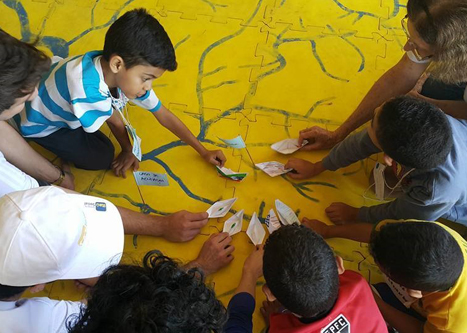
This article presents a connection between social cartography and environmental design. The social cartography brings new contributions to the traditional cartography, breaking the paradigm that maps should only be designed by governmental agencies, it proposes that the people itself design their own maps so that they can be critics and take part in the process. The participatory mapping have a social function, in the way that it helps territory management, identifying the traditional uses of the territory, its struggles, its frailties, its potential, empowering these people, encouraging then to take action upon this territory searching for ways to transform it or to secure their rights over it. The objective of this paper is to show how the participatory methodologies studded in this research, the participatory mapping and the affective mapping can contribute to the environmental design in its initial stages seeking the participation of the populace in the urban planning as they organize their visions about the territory, articulating and proposing dialogues with the community and (or) external agents or through their own initiatives seeking the transformation of their lived reality. The applied methodology in this paper was one of a documental and bibliographic research who had the intent of establish an overview of the situation regarding the creation of participatory environmental designs through participatory mapping and affective mapping. In the context of the study area it was selected experiences were the social cartography was used as a support to increase community awareness and as an example of the participation of the environmental design in urban environment.
Downloads
References
ACSELRAD, Henri; COLI, Luis Régis. Disputas cartográficas e disputas terrritoriais. In: ACSELRAD, Henri et al (Org.). Cartografias Sociais e Território. Rio de Janeiro: Ippur/ufrj, 2008.
AMARAL, Gloria Regina. Belterra já tem seu Plano Diretor. FASE Amazônia. Rio de Janeiro, 20 dez. 2006. Disponível em: <https://fase.org.br/pt/informe-se/noticias/belterra-ja-tem-seu-plano-diretor/> Acesso em 19 maio 2019.
ARAÚJO, Franciele E.; ANJOS, Rafael S.; ROCHA-FILHO, Gilson B. Mapeamento participativo: conceitos, métodos e aplicações. Boletim de Geografia, Maringá, v. 35, n. 2, p. 128-140, 2017. Disponível em: http://periodicos.uem.br/ojs/index.php/BolGeogr/article/view/31673/pdf. Acesso em: 10 maio 2019.
BERTRAND, Georges. Paisagem e geografia física global: esboço metodológico. RA’E GA, Curitiba, n. 8, p. 141-152, 2004. Disponível em: <https://revistas.ufpr.br/raega/article/view/3389/2718>. Acesso em: 23 maio 2019.
BEZERRA, Yandra Raquel N.; FEITOSA, Maria Zelfa S. A afetividade do agente comunitário de saúde no território: um estudo com os mapas afetivos. Ciência & Saúde Coletiva, Rio de Janeiro, v. 23, n. 3, p. 813-822, 2018. Disponível em: http://www.scielo.br/scielo.php?script=sci_arttext&pid=S1413-81232018000300813&lng=en&nrm=iso. Acesso em: 13 maio 2019.
BRASIL. Lei nº 10.257, de 10 de julho de 2001. Regulamenta os arts. 182 e 183 da Constituição Federal, estabelece diretrizes gerais da política urbana e dá outras providências. Diário Oficial da União: seção 1, Brasília, DF, 11 jul. 2001. Disponível em: http://www.planalto.gov.br/ccivil_03/leis/leis_2001/l10257.htm. Acesso em: 23 maio 2019.
BUENO, José; CAMPOS JR., Luiz. Entrevista com Rios e Ruas. Revista LABVERDE, São Paulo, n. 7, p. 224-229, 2013. Disponível em: https://www.revistas.usp.br/revistalabverde/article/view/81120/84747. Acesso em: 13 maio 2019.
CHAPIN, Mac. Proyectos de mapeo: identificación de obstáculos y hallazgo de soluciones. Aprendizaje y Acción Participativos, Lima, n. 54, p. 1-6, 2006. Disponível em: http://191.98.188.189/Fulltext/7936.pdf . Acesso em: 15 maio 2019.
FERNANDES, Wellington de O. Mapeamento participativo na cartografia: discussão sobre experiências de aplicação dessa metodologia a partir da cartografia social. 2013. 80 f. Trabalho de Conclusão de Curso (Bacharelado em Geografia) – Universidade de São Paulo, São Paulo, 2013.
FOX, Jefferson; SURIANATA, Krisnawati; HERSHOK, Peter; PRAMONO, Albertus H. O poder de mapear: efeitos paradoxais das tecnologias de informação espacial. In: ACSELRAD, Henri. (Org.). Cartografias sociais e território. Rio de Janeiro: IPPUR: UFRJ, 2008. p. 71-84.
FRANCO, Maria de Assunção R. Desenho ambiental: uma introdução à arquitetura da paisagem com o paradigma ecológico. São Paulo: Annablume: Fapesp, 1997.
GORAYEB, Adryane; MEIRELES, Jeovah. A cartografia social vem se consolidando como instrumento de defesa de direitos. [Entrevista cedida a] Eliane Araújo. Rede Mobilizadores, [S. l.], 9 fev. 2014. Disponível em: http://www.mobilizadores.org.br/entrevistas/cartografia-social-vem-se-consolidando-com-instrumento-de-defesa-de-direitos/. Acesso em: 28 abr. 2019.
HAESBAERT, Rogério. Dos múltiplos territórios à multiterritorialidade. PET Geografia, Porto Alegre, 2004. Disponível em: http://www.ufrgs.br/petgea/Artigo/rh.pdf. Acesso em: 2 jun. 2019.
HARLEY, Brian. Mapas, saber e poder. Confins, São Paulo, n. 5, 2009. Disponível em: http://www.ppghis.ufma.br/wp-content/uploads/2016/08/7-John-Brian-Harley-Mapas-saber-e-poder.pdf. Acesso em: 3 maio 2019.
HART, Sasha. Caren Lissa Harayama e seus marinheiros, navegando até o Rio da Goiaba no Campo Limpo. Facebook, [S. l.], 16 maio 2015. Disponível em: https://www.facebook.com/rioseruas/photos/a.136652653060846/888908511168586/?type=3&theater. Acesso em: 13 maio 2019.
LIMA, Myriam D. V.; MACHADO, Cláudia C. L.; ALVES, João B.; FORTUNATO, Rafaela A. Governança pública para o enfrentamento das mudanças climáticas em Curitiba e entorno. Mercator, Fortaleza , v. 15, n. 4, p. 47-63, 2016 . Disponível em: http://www.scielo.br/scielo.php?script=sci_arttext&pid=S1984-22012016000400047&lng=en&nrm=iso. Acesso em: 6 jan. 2020.
LOURENÇO, Luiz Augusto F. Mapas afetivos. Dicionário de Favelas Marielle Franco, Rio de Janeiro, 2019. Disponível em: https://wikifavelas.com.br/index.php?title=Mapas_Afetivos.Acesso em: 20 abr. 2019.
MONTEIRO, Tuanne F. et al. Educação ambiental e patrimonial a partir dos afetos da juventude de Jacarecanga. Extensão em Ação, Fortaleza, v. 2, n. 3, p. 75-88, 2012. Disponível em: <http://periodicos.ufc.br/extensaoemacao/article/view/3856/3047>. Acesso em: 15 maio 2019.
PAIVA, Ângela. Na floresta têm direitos: justiça ambiental na Amazônia. Mapa dos Conflitos Socioambientais da Amazônia Legal, Belém, 2009. Disponível em: https://fase.org.br/wp-content/uploads/2009/08/2_mapa_conflito_amazonia-1-3.pdf. Acesso em: 21 maio 2019.
PELLEGRINO, Paulo R. M. Pode-se planejar a paisagem? Paisagem e Ambiente, São Paulo, n. 13, p. 159-179, 2000. Disponível em: <http://www.revistas.usp.br/paam/article/view/134128/129939>. Acesso em: 20 maio 2019.
ROCHA, Yuri T. Teoria geográfica da paisagem na análise de fragmentos de paisagens urbanas de Brasília, São Paulo e Rio de Janeiro. Revista Formação, Presidente Prudente, v. 1, n. 15, p. 19-35, 2008. Disponível em: <http://www2.fct.unesp.br/pos/geo/revista/artigos/3_rocha.pdf>. Acesso em: 23 maio 2019.
SANTOS, Rozely F. Planejamento ambiental: teoria e prática. São Paulo: Oficina de Textos, 2004.
SCHIPPER, Ivy. A cartografia da ação na escola e a pesca em São Gonçalo (RJ). Revista Tamoios, São Gonçalo, v. 6, n. 1, p. 34-47, 2010. Disponível em: <https://www.e-publicacoes.uerj.br/index.php/tamoios/article/download/1168/3030>. Acesso em: 20 maio 2019.
TOMAZ, Yasminni P. Conservação ambiental e mapeamentos participativos: territórios disputados da Caçandoca e do Sertão da Fazenda – Ubatuba – SP. 2017. 114 f. Trabalho de Graduação Individual (Bacharelado em Geografia) – Universidade de São Paulo, São Paulo, 2017. Disponível em: <http://www.tcc.sc.usp.br/tce/disponiveis/8/8021104/tce-16032018-184815/?&lang=br>. Acesso em: 12 maio 2019.
Downloads
Published
Issue
Section
License
Copyright (c) 2020 Yasminni Parra Tomaz

This work is licensed under a Creative Commons Attribution-NonCommercial-ShareAlike 4.0 International License.
O detentor dos direitos autorais é o autor e eventuais coautores do artigo. A Revista LABVERDE exige apenas o ineditismo na publicação do artigo. O autor tem o direito de divulgar seu artigo conforme sua conveniência devendo citar a revista.
A Revista LABVERDE autoriza a republicação de seus artigos desde que devidamente citada fonte e autoria.

